
Hungary, Serbia, Croatia, Bosnia
Low estimate
High estimate
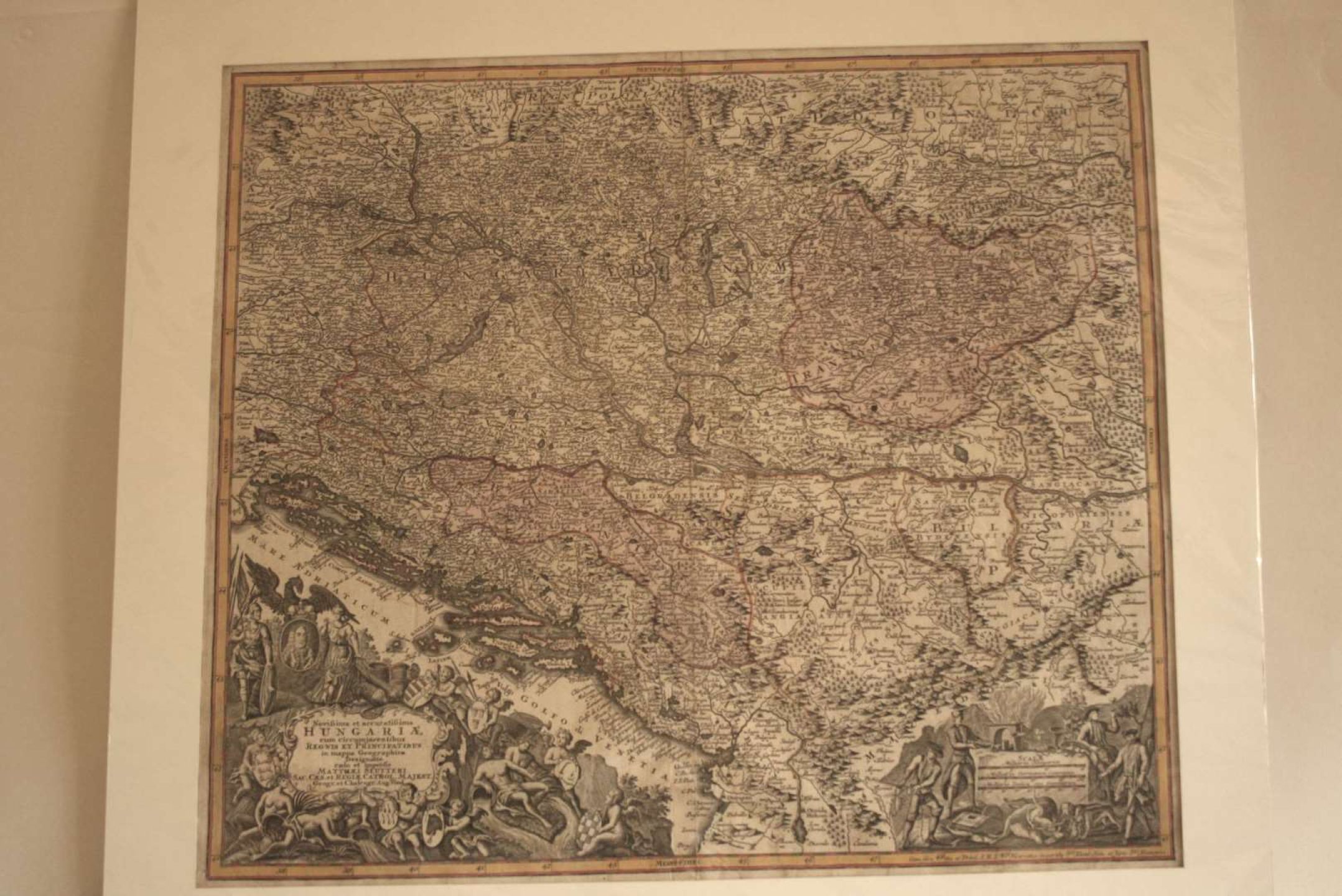
Enhanced map of Hungary, Serbia, Croatia, Bosnia: "Novissima et Accuratissima Hungariae cum circumjacentibus Regnis et Principatibus" by Matthäus SEUTTER (1678-1757), circa 1730 - Size: 50.5 x 58.5 cm
Automatically translated by DeepL. The original version is the only legally valid version. To see the original version, switch to the French language.


